Project Highlights
Tier-1 Jurisdiction, Arizona USA
100% owned Project
Initial field work and drilling at Silver Mountain confirmed prospectivity of Project
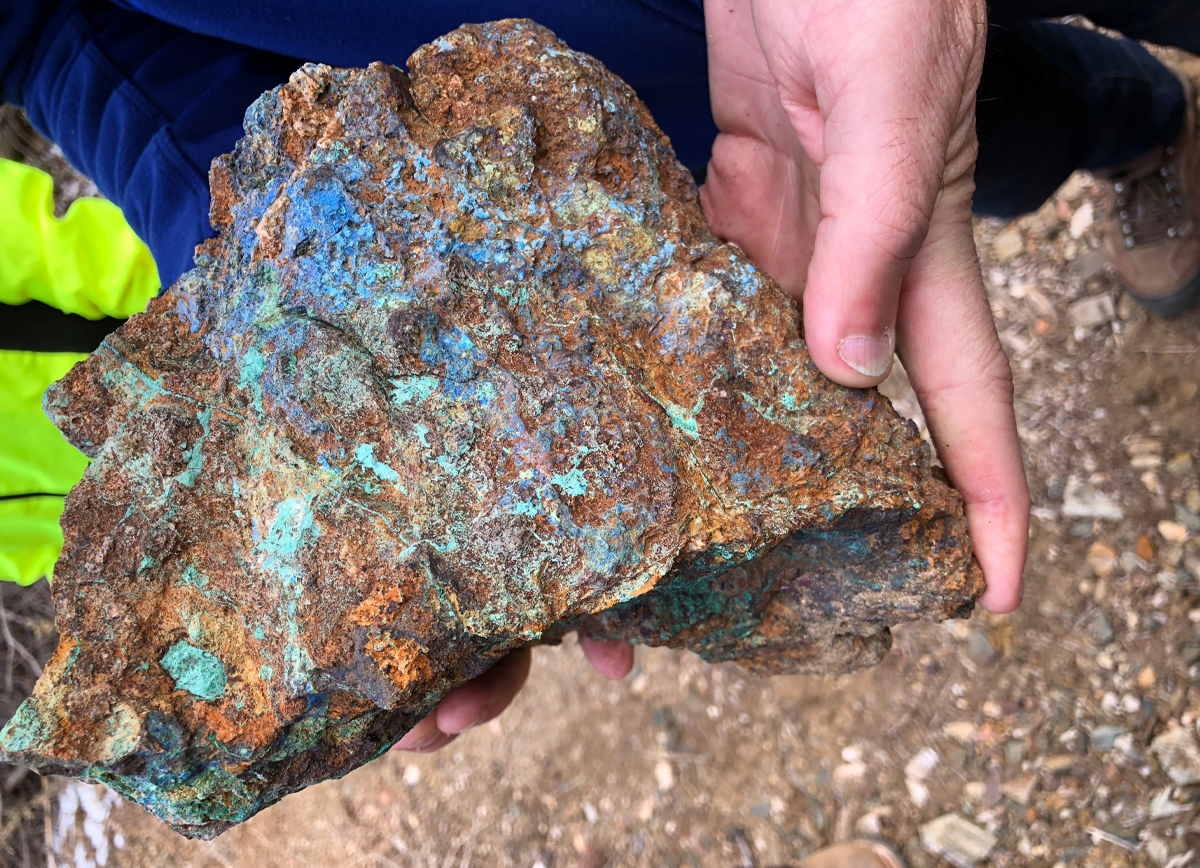
Host of multiple historic base and precious metal mines, with grades up to 64g/t gold, 445g/t silver and 10% copper
Porphyry indicators confirmed in drilling and field programs
Geophysical anomalies support potential for porphyry system
Field work ongoing to define full potential
Overview
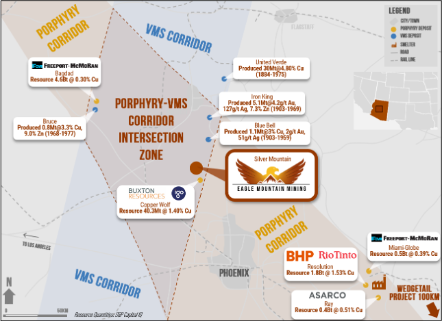
The Silver Mountain Project is a greenfields project located in Yavapai County, Arizona, USA, approximately 100 kilometres northwest of Phoenix and within the Laramide Arc – a northwest-southeast trending geological feature containing world-class porphyry copper mines such as Bagdad, Miami and Resolution. It also lies on the southern extension of a northeast-southwest prospective metallogenic belt that hosts the historical United Verde and Iron King volcanogenic massive sulphide (VMS) mines.
Some of the compelling factors for the project include its geological setting and lack of modern day exploration.
Project Location
The Silver Mountain Project is located in Yavapai County, Arizona, USA, approximately 100 kilometres northwest of Phoenix
Arizona has a rich copper mining history and has been host to a number of world class copper mines. The nearby San Manuel copper mine was the world’s largest underground copper mine by the 1980’s and produced over 700 million tons of ore from underground alone. The Arizona mining sector is well supported by world-class infrastructure and a highly skilled workforce. The Project appeal is based on a number factors, including the highly prospective copper-gold region.
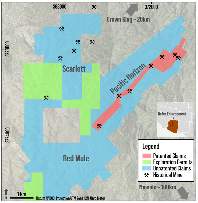
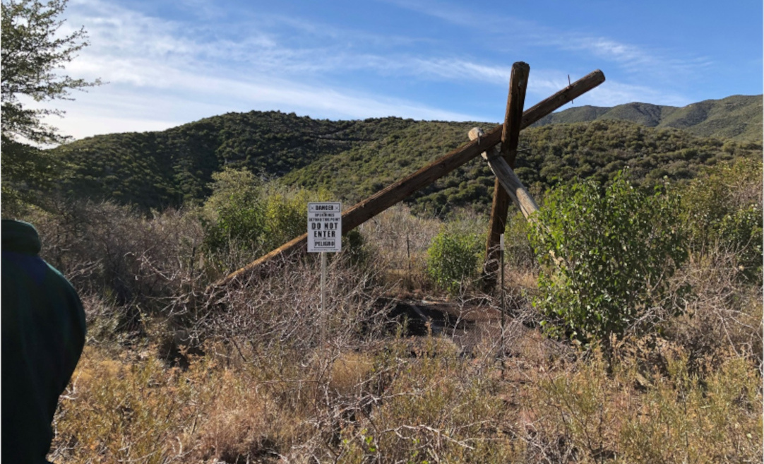
Silver Mountain encompasses three prospective areas – Pacific Horizon, Scarlett, and Red Mule – situated approximately 20 kilometers from Crown King, Arizona. These areas are accessible by unsealed roads.
Location Map and Surrounding Deposits
Silver Mountain Tenements
GEOLOGY AT PROSPECTS
Silver Mountain comprises three prospects that exhibit favourable geological characteristics for hosting significant base and precious metal deposits in addition to porphyry-style targets. Eagle Mountain is eager to complete further exploration work to define the full potential.
Silver Mountain Prospect & Tenements
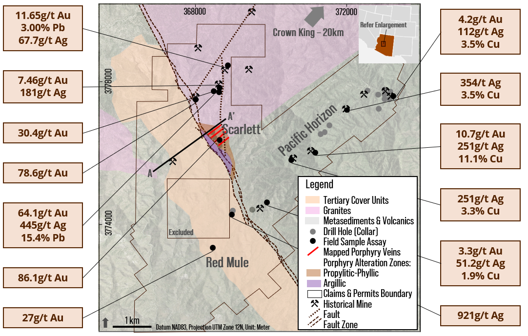
- Scarlett is characterised by a major northwest-southeast trending fault zone dividing the prospect into two distinct geological domains. The eastern domain hosts gold-bearing quartz veins with associated phyllic alteration, whereas the western domain is covered by Tertiary units. The veins may be an expression of a buried porphyry system, which is partially covered by the Tertiary units. Limited historical mining focused on the mineralised veins. Geophysical anomalies and limited initial drilling suggest the potential for a blind porphyry system.
Silver Mountain Conceptual Geology Section
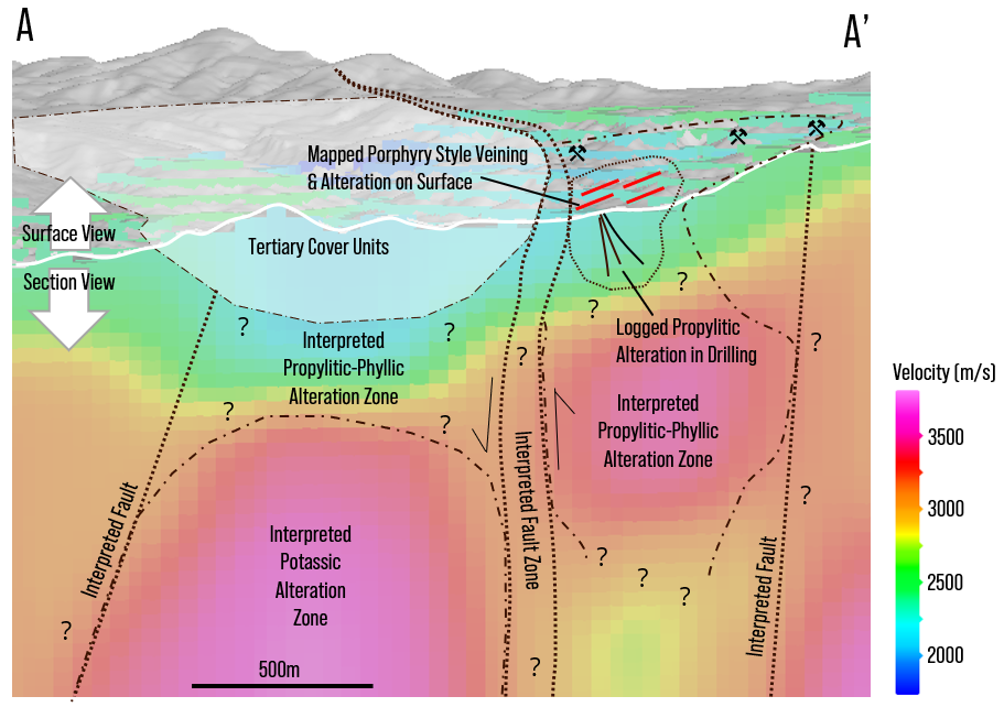
Mineralised Veins & Porphyry-Style Targets – Scarlett Area
- Red Mule is located at the southern end of the project area. The geology comprises a mix of Proterozoic metasediments and volcanics to the east, and Tertiary cover units to the west. Alteration and mineralisation are associated with the major northwest-southeast trending fault zone, indicating potential for base and precious metal mineralisation at depth.
- Pacific Horizon comprises Proterozoic metasediments and volcanics with late stage copper-gold-silver carbonate breccias positioned along the northeast-southwest trending VMS horizon. Historical mining targeted these high-grade breccia zones. Extensive exploration activities, including drilling and geophysical surveys, have delineated several base and precious metal targets.
